At a Glance
- A Caribbean tropical disturbance is likely to become a tropical depression or storm.
- Tropical development could happen as soon as late week or this weekend.
- Interests from the western U.S. Gulf Coast to Mexico should monitor this closely.
A low-pressure system in the Caribbean Sea is likely to organize into a tropical depression or storm as soon as later this week and could be a potential concern from Mexico to the western half of the U.S. Gulf Coast.
It's too early to know what impacts this system might bring to portions of the western Gulf Coast early next week, but interests from Louisiana and Texas to Mexico should monitor its progress closely the next several days until the forecast comes into greater focus.
Ida and Julian will be the names given to the next two tropical storms that form in the Atlantic this season.
Forecast
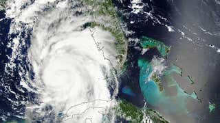
The disturbance is currently located in the southwest Caribbean Sea, as depicted by the red "X" in the map below.
This system has been designated Invest 99L by the National Hurricane Center, which is a naming convention used to identify features they are monitoring for possible formation into a tropical depression or storm.
Late this week into the weekend is when forecast models depict a tropical depression or storm forming from this disturbance. That could happen anywhere in the red-shaded area in the map below, near Central America to Mexico's Yucatan Peninsula and the southern Gulf of Mexico.
There will at least be a heavy rain threat from parts of Central America to the Yucatan Peninsula by later this week through the weekend.

The forecast is even more unclear once this system reaches the Gulf, but one worth watching over the next few days, especially if you live along the western Gulf Coast, from Louisiana to Texas and Mexico.
The disturbance, or a tropical depression or storm, could be located somewhere in the southern Gulf of Mexico by late Saturday or early Sunday.
Exactly where this system tracks from there will be partially determined by where it eventually consolidates and develops a well-defined low-pressure system. That is an unknown factor at this time.
Another important factor is the position and strength of a ridge of high pressure to its north over the southern United States. This high will be the large-scale steering wheel for the system, with its clockwise circulation sending it either northwest or westward through the Gulf.
Trends on Wednesday suggested that a more northward trek through the Gulf of Mexico is possible, but this may not be a trend if the center forms elsewhere than where models on Wednesday suggested the center would form.
The bottom line is there is the potential for a tropical storm or hurricane threat along the western half of the Gulf Coast early next week since atmospheric conditions could be favorable for strengthening. However, it's too early to be specific about the eventual outcome for this system and any potential impacts. Forecast changes are likely over the next few days, so it's best to stay informed.

Regardless of what happens, this system will at least bring a surge of moisture that enhances rainfall near the western U.S. Gulf Coast early next week. Coastal areas could also see high surf and rip currents.
The Weather Company’s primary journalistic mission is to report on breaking weather news, the environment and the importance of science to our lives. This story does not necessarily represent the position of our parent company, IBM.


