At a Glance
- A tropical disturbance will track through the western Gulf of Mexico through Saturday.
- It appears likely to organize into a tropical depression prior to moving inland Saturday night.
- Regardless of development, this system could enhance rainfall in South Texas, but major impacts are not expected.
A disturbance will track across the western Gulf of Mexico through Saturday where it is likely to develop into a tropical depression and possibly enhance rainfall as far north as South Texas.
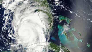
The system is located over the southwest Gulf of Mexico right now, as depicted by the "X" on the map below, and is producing clusters of showers and thunderstorms.
The National Hurricane Center (NHC) has tagged this system as Invest 99L. This naming convention is used to identify disturbances in the Atlantic that the NHC is tracking for possible development into a tropical depression or storm.

A hurricane hunter plane is flying into the system to see if it has such a center of circulation. If that is found, then it would be classified as a tropical depression.
That said, it will have limited time over the Gulf. It will track toward the coast of northeast Mexico and likely move ashore by Saturday night.
Some bands of locally heavy rain could trigger flash flooding in parts of northeast Mexico and Deep South Texas through Saturday night or early Sunday.
However, we do not expect a widespread, heavy soaking rain like we saw in South Texas this past Sunday and Monday.

Hurricane season is entering its typical peak in activity which includes late August, September and early October. The next named storm in the Atlantic will be Danielle.
Check back to weather.com frequently for updates on what to expect in the Atlantic through the coming weeks.
The Weather Company’s primary journalistic mission is to report on breaking weather news, the environment and the importance of science to our lives. This story does not necessarily represent the position of our parent company, IBM.


