At a Glance
- The long-slumbering Atlantic Basin is finally showing signs of waking up.
- Multiple areas are being monitored for possible development.
- One is in the Caribbean Sea and the others are in the Atlantic.
- It's not clear yet whether any of these will eventually pose a threat to the U.S.
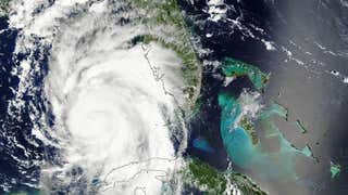
The Atlantic hurricane season is awakening and now multiple areas are being tracked for possible formation into the next tropical depression or storm.
It's been almost two months since we've had a tropical storm in what has been one of the quietest starts to a hurricane season in decades. But we're heading into the peak of hurricane season and, right on cue, activity is percolating again.
Here's what you need to know about each of these areas we're watching, and some barriers that might hamper development.
Danielle, Earl and Fiona are the next three names in the 2022 list of tropical storms and hurricanes.
Central Tropical Atlantic
- When it could develop: Later this week
- Where it could head and when: Near or north of the Lesser Antilles by Friday
- After that: It's too early to say whether this system might impact any other land areas, including the Bahamas, Bermuda or even the Southeast U.S. by sometime next week.
This system is producing clusters of showers and thunderstorms associated with a broad area of low pressure about halfway between Africa and the Lesser Antilles right now. It's been dubbed Invest 91L by the National Hurricane Center, which is a naming convention used to identify disturbances that could form into a tropical depression or storm.
Despite nearing the heart of hurricane season, there are two roadblocks that could hinder the development of this system for now. One factor is dry air and the other is unfavorable upper-level winds.
Regardless of development, forecast models suggest this area could develop and head slowly west-northwest to an area near or north of the Lesser Antilles by late in the week ahead. It is far too soon to tell if this may eventually pose a threat to the mainland U.S. the week of Labor Day.

Caribbean Sea
- When it could develop: Late this week
- Where it could head and when: Yucatan Peninsula late this week or over the weekend.
- After that: If it develops at all, it could emerge into the western Gulf of Mexico on Labor Day weekend.
The northwest Caribbean is being watched for the potential formation of an elongated area of low pressure by midweek. For now, few computer forecast models are suggesting strong development from this system, but it's worth monitoring given the typical supply of deep, warm water in its path.

Eastern Atlantic
- When it could develop: Middle to late part of the week ahead
- Where it could head and when: Should remain over eastern Atlantic much of the week ahead into Labor Day weekend.
This system is another tropical wave that will soon emerge over the Atlantic from Africa.
This one may bring some showers and squalls to the Cabo Verde Islands around midweek, but then should remain over the open waters of the eastern Atlantic Ocean through Labor Day weekend.

Central Atlantic
- When it could develop: Likely to dissipate by midweek
- Where it could head and when: It will continue to meander over the Atlantic
There is a small low pressure system swirling to the east of Bermuda right now.
Strong shear and a layer of dry air are expected to limit development this week as the system continues to move over the Atlantic.
For now, there's nothing to be overly concerned about with any of these systems.
Check back with us at weather.com for updates, as forecasts can quickly change in these peak months of the hurricane season.
However, it's a good time to make sure you have a plan in place in case of a hurricane. Information about hurricane preparedness can be found here.
More from weather.com:
12 Things You May Not Know About Your Hurricane Forecast
Latest Updated Hurricane Season Outlook
7 Things Florida Newcomers Should Know About Hurricane Season
The Weather Company’s primary journalistic mission is to report on breaking weather news, the environment and the importance of science to our lives. This story does not necessarily represent the position of our parent company, IBM.


