

At a Glance
- Wildfires so far this year have burned 160% more land than the 10-year average.
- New Mexico saw its largest fire ever.
- California's year-to-date fire activity is much lower than recent years.
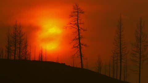
Wildfires in the U.S. so far this year have racked up some astonishing numbers, burning 160% more land than the 10-year average.
But that doesn't tell the whole story. Some areas are seeing unusually large areas burned and others less than normal.
With the worst time of year for wildfires now kicking into high gear for many regions, here's a look at what's in play.
The Outlook
Several areas of the U.S. including parts of California, the Northwest, the Central Plains and the South have above average wildfire potential through at least September, according to the latest outlook released Monday by the National Interagency Fire Center, or NIFC.
Texas has already seen deadly wildfires, and the above-average potential continues for most of the state. The risk also stretches into portions of the Mississippi and Missouri valleys.
While wildfire season is getting longer and its timeline varies by location, late summer into early fall is typically the most active time. Some agencies are shifting away from the term "season" altogether and using "wildfire year" instead.
For More: Spring/Summer Fire Outlook ---- Deadly Wildfires Race Through Texas ---- Study Finds That The Poor Face Disproportionate Wildfire Risk
Drought and Heat
Many of the most at-risk areas coincide with regions that are in the midst of brutal drought conditions, according to the U.S. Drought Monitor. Some have been unusually dry for months and even years. On top of all that, some of these areas are also having a hotter-than-usual summer.

More: West In Worst Drought In 1,200 Years ---- Study Finds Drought Behavior Varies By Location ---- Could 2022 Be The Hottest Summer On Record In Texas? ---- More Brutal Heat In Parts Of U.S. In August, Latest Outlook Shows
Weather and Climate
Daily weather that is dry, warm and windy creates prime conditions for wildfires. But climate - which refers to longer term trends - also plays a big role. Scientists say global warming is changing our climate, and that's making wildfires worse. "Climate change has increased the frequency and severity of both drought and extreme high temperatures, and both of these contribute to larger fires and more extreme fire behavior," Jacob Bendix, a professor of geography and the environment at Syracuse University, told weather.com in an email earlier this summer.
Rain helps, but not always. Trees, grass and other vegetation are fire fuels. "If you have severe or extreme long-term drought that affects bigger plants," Nick Nauslar a meteorologist with NIFC, explained in a recent phone call. ”However, when you’re in more arid or grass-dominated ecosystems you need rain to grow the fuel." Grasses and similar vegetation dry out surprisingly fast, especially in the kinds of heat waves seen across much of the country this summer.
More: Climate Change Plays A Role In Worsening Wildfires ---- Climate Change Impacts On Everyday Life Shown in New Federal Reports ---- Dangerous Combination Of Intense Wildfires + Extreme Rainfall Could Happen More Often
The Numbers
More than 5,700 square miles of land have been scorched by wildfires so far this year in the U.S., according to the NIFC. That only includes large fires tracked on a national level.
Early fires in Alaska and parts of the Southwest helped drive those numbers, Nauslar said. New Mexico, for example, saw its biggest wildfire ever on record, with hundreds of homes destroyed.
Alaska accounted for an unusually large amount of land burned in the late spring and early summer. After a cool and wet winter and spring, Nauslar said, Alaska got hot and dry and had a lot of lightning, which sparked wildfires. Plus, he added, blazes in Alaska are often in areas with little to no population, so they aren't as aggressively fought. The state is predicted to have normal wildfire potential for the rest of the year.
On the other hand, some areas are getting a bit of a reprieve compared to recent years, many of which have been above average for fire activity. About 230 square miles of land burned in California from Jan. 1 to Aug. 1, compared to a 5-year average of nearly 900 square miles for the same time period. “We haven’t seen the amount of significant fire activity in multiple geographic areas like we did the last two years," Nauslar said.
More: Alaska On Fire: What’s Driving Record Fire Pace ---- Beginning Of California’s Deadly Fire Captured In Dramatic Video ---- Western Wildfires, In Photos
The Weather Company’s primary journalistic mission is to report on breaking weather news, the environment and the importance of science to our lives. This story does not necessarily represent the position of our parent company, IBM.


