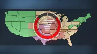
At a Glance
- A widespread storm will track through the central and eastern states during the first half of the week.
- A severe weather outbreak is increasingly likely in parts of the South.
- Flooding rain is possible from the South into portions of the Midwest.
- Snow could fall from the Rockies to the Upper Midwest.
A classic springtime storm will trigger numerous severe thunderstorms and heavy rain in parts of the central and southern U.S. this week, while possibly wringing out snow from the Rockies and adjacent High Plains to the Upper Midwest.
A severe weather outbreak is possible across the South beginning Monday and ending as late as Wednesday.
Spring officially started Sunday, and while that happened, a sharp southward plunge of the jet stream and an area of low pressure aloft started tracking across the Southwest. By Monday, that storm system will have tapped into a supply of moisture from the Gulf of Mexico, leading to the development of widespread rain and thunderstorms in the southern and central U.S.
Those storms will likely produce tornadoes, damaging winds and large hail in parts of the South as the system tracks eastward through the middle part of the week. Flooding rain is also a potential threat from portions of the South into the Midwest.

What's not certain yet is the magnitude and locations of the greatest tornado, damaging wind, large hail and flooding rain threats. Those details will become more certain once the ingredients come more into focus.
Here's an overview of what to expect, but be sure to check back for updates.
Forecast
Monday
Monday is when rain and thunderstorms will become widespread throughout the Plains and possibly as far east as the lower Mississippi Valley.
The threat of severe storms will also escalate Monday into Monday night. Right now, an area across central and eastern Texas has the highest potential for severe weather.
A severe weather outbreak is increasingly likely. Tornadoes, damaging winds and large hail will all be potential threats. A significant tornado or two are possible from east Texas into western Louisiana.
Snow and strong winds might impact the Rockies and adjacent High Plains, possibly including the Denver metro area.

Tuesday
The severe weather outbreak will likely be ongoing on Tuesday across portions of the Deep South.
Severe storms, likely packing damaging winds, hail and tornadoes, are most probable from eastern Louisiana into much of Mississippi and Alabama.
The storm system that will bring this severe weather threat will also spread rain and thunderstorms across most of the Mississippi Valley with storms moving eastward into much of the Midwest Tuesday and Tuesday night.
Heavy rain and flooding could impact portions of the Ohio Valley into the South.
This system could also continue to produce snow, or a mix of rain and snow, along with gusty winds, in the Plains and upper Midwest.

Wednesday
Soaking rain and thunderstorms will spread toward the Southeast and Northeast by the middle of next week.
Parts of Georgia, Alabama and northern Florida might have a bout of strong to severe storms.
Snow could fly through the air in the upper Midwest, northern Great Lakes and into the interior Northeast Wednesday night.

Rain and thunderstorms will push toward the East Coast Thursday, with a wintry mix in parts of the interior Northeast. At this time, the severe threat appears more limited but check back for updates in the days ahead.
Rainfall Forecast
At least an inch of rain might soak a broad area from the Plains into the Mississippi and Ohio valleys Monday through Wednesday of next week. Some areas could see multi-inch rainfall totals.
This is good news for drought areas in the Plains and lower Mississippi Valley. But it could also trigger at least localized flooding – including in drought areas – if too much rain falls in a short amount of time.

The Weather Company’s primary journalistic mission is to report on breaking weather news, the environment and the importance of science to our lives. This story does not necessarily represent the position of our parent company, IBM.


