At a Glance
- A second round of heavy rain will impact California through early Wednesday.
- Flooding and debris flows are serious threats.
- Feet of snow will fall in the Sierra, but it will be confined to above 7,000 ft.
Sign up for the Morning Brief email newsletter to get weekday updates from The Weather Channel and our meteorologists.
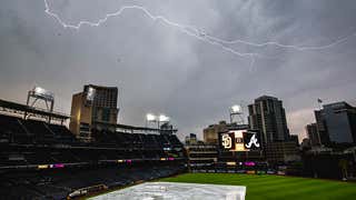
Another atmospheric river event is hitting the West Coast, just days after California was drenched in heavy rain and high-elevation snow last week.
Last week's atmospheric river brought up to a foot of rain in the coastal ranges of central California and the foothills of the Sierra Nevada. In the Sierra, one to two feet of additional snow fell on top of the already impressive snowpack.
Now, the current atmospheric river event is bringing more rain and snow to the same areas.
(READ: What is an atmospheric river?)
Current Conditions
Rain and mountain snow stretches across much of Northern California, and rain is falling in Southern California.
There is some good news in that rainfall is tapering a bit in parts of central California, including the Bay Area, as drier air moves in.

Since rain picked up late Monday night, there have been over two dozen reports of flooding across Northern California from the Mendocino Coast to the Sierra foothills to near Monterey Bay.
Numerous roads were closed in Butte County due to flooding. Some mudslides and rockslides were also reported, including one covering both lanes of Skyline Boulevard above Stanford, California.

The strong winds from the storm and soaked ground has also lead to several downed trees, some blocking roads, including in parts of the Bay Area.
Over a foot of snow has already fallen at the UC Berkeley Central Sierra Snow Lab at an elevation of just under 7,000 feet.
Weather Alerts
The National Weather Service has issued flood watches for much of California, including the lower elevations of the Sierra. Flooding is likely due to the combination of recent rainfall, snowmelt and additional heavy rain.
Soils are saturated and rain will run off causing flash flooding, as well as rises in creeks, streams and rivers. Minor to moderate river flooding is possible in some areas.
Winter storm warnings continue in the Sierra Nevada, including the Interstate 80 corridor, where heavy snowfall and strong winds may make travel very difficult to impossible.

High wind warnings have been posted by the National Weather Service, along with wind advisories. Wind gusts over 50 mph are possible in areas under high wind warnings. Strong winds may down trees and knock out power.

This system is tapping another atmospheric river, bringing plenty of moisture to the West Coast.

Forecast
As alluded to earlier, rain will taper off for some in central California as drier air pushes in, including the Bay Area.
In Southern California, rain is expected to continue into early Wednesday morning before winding down.
Rain and snow totals will be similar to the last event:
With snow levels being well-elevated into the Sierra, rainfall totals in the foothills of the Sierra and the mountains of the Pacific Coast will be 3 to 6 inches and potentially higher in the foothills of the northern Sierra.
Several inches of rain are likely in Southern California, including elevations below 8,000 feet in the San Gabriel mountains. This will lead to dangerous flash flooding of roads, creeks, streams, mud and rockslides in elevated terrain, and the potential for debris flows in areas recently burned by wildfires.
Snowfall totals in the higher elevations of the Sierra Nevada will likely be at least 1 to 3 feet through Wednesday morning.

Here are some steps you can take: If it can be safely done, clear as much snow off your roof as possible before this storm arrives to minimize the stress from the weight of snow, plus any rain that could fall.
In lower elevations, clear any gutters, curbs and other drainage areas of debris to allow water to drain away.
Be ready to evacuate due to debris flows at a moment's notice if you live near an area recently burned by a wildfire. If you encounter a flooded road, never attempt to drive through it. Turn around, instead.
The Weather Company’s primary journalistic mission is to report on breaking weather news, the environment and the importance of science to our lives. This story does not necessarily represent the position of our parent company, IBM.


