Satellite images tracking the large bomb cyclone that has been moving its way across California in the past 24 hours show the sheer scale of the storm battering the Golden State, leading to flooding, power outages and evacuation orders in some coastal areas.
On Wednesday, California Governor Gavin Newsom declared a state of emergency, standing up a Flood Operations Center.
"California is mobilizing to keep people safe from the impacts of the incoming storm," Newsom said in a statement.
The weather front is the third storm to hit the west coast in recent weeks; one that broke over the state on New Year's Eve caused serious flooding and left at least two people dead.
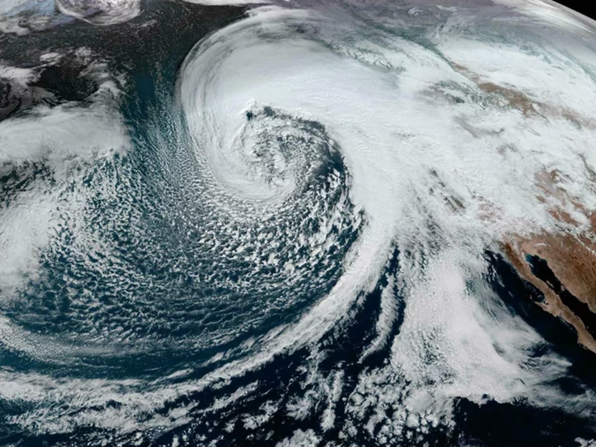
The latest storm has dumped water in such large quantities as a bomb cyclone—which through a rapid drop in pressure is able to bring strong winds and intense rain—combined with a corridor of air, dubbed the Pineapple Express, flowing into California.
Colin McCarthy, an extreme weather tracker and MyRadar contributor, described the weather front as "one of the most spectacular-looking and powerful bomb cyclones I have ever seen."
Beginning Wednesday and continuing through the night into Thursday, the weather front is expected to move eastward, with "damaging winds, excessive rainfall, and extremely heavy snow" and is due to hit most of California and southern parts of Oregon, according to the National Weather Service (NWS).
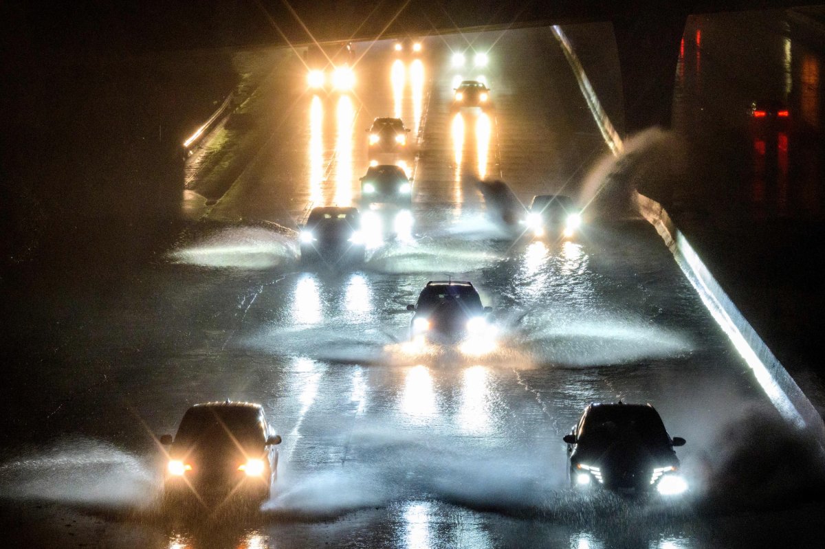
NWS gauges show moderate flooding near San Jose—which on Tuesday declared an emergency—and Santa Rosa, as well as major flooding near Petaluma. Flood advisories are in place for much of northern California.
"The associated heavy rain will create mainly localized areas of flash flooding, with urban areas, roads, small streams, and burn scars the most vulnerable," the NWS said in an update in the early hours of this morning. "Additionally, widespread wind gusts in excess of 50 mph and saturated soils may make trees more susceptible to blowing down."
The potential for falling trees and debris flows has prompted officials in some areas to issue evacuation orders for residents, including areas of Santa Barbara County that had recently experienced wildfires.
The fire department in Montecito—a coastal town home to celebrities such as Oprah Winfrey, Prince Harry and Meghan Markle—ordered the evacuation of areas likely to be hit by mudslides in the early hours of this morning.
"It is our intent to get everyone safely back home as soon as the storm passes," fire chief Kevin Taylor said in a statement. "For now, our focus is evacuating areas at greatest risk and preventing loss of life and property."
While the series of devastating storms expected to hit California in the coming days are likely to alleviate some of its severe drought problems, the sudden nature of the rainfall after many months of arid conditions means the earth will not be able to absorb the water effectively, causing more intense flooding.
"We are in the middle of a flood emergency and also in the middle of a drought emergency," Karla Nemeth, director of the state's Department of Water Resources, said during an emergency briefing, according to local news channel WRTV.
The Pineapple Express is a corridor of air that is able to carry a large amount of moisture with it. The colder, Arctic air of the bomb cyclone cools this warmer air, causing a heavy burst of precipitation.

"What's happening here—and it's partly weather, partly climate change—is rain is falling more heavily because there is more moisture in the atmosphere, because the atmosphere is warmer," Mark Maslin, professor of Earth system sciences at University College London and a climate author, told Newsweek.
"What's been happening, we've seen, for the last 50 or 60 years is rainfall events are becoming shorter and more intense as that weight of water in the atmosphere, when it gets to a critical point, literally drops."
In terms of intensity, Michael Snyder, an aviation weather expert, suggested that as much as 24.4 trillion gallons of water would fall over California in the next 15 days, calling this a "fairly conservative approximation."
Uncommon Knowledge
Newsweek is committed to challenging conventional wisdom and finding connections in the search for common ground.
Newsweek is committed to challenging conventional wisdom and finding connections in the search for common ground.
About the writer
Aleks Phillips is a Newsweek U.S. News Reporter based in London. His focus is on U.S. politics and the environment. ... Read more
To read how Newsweek uses AI as a newsroom tool, Click here.