
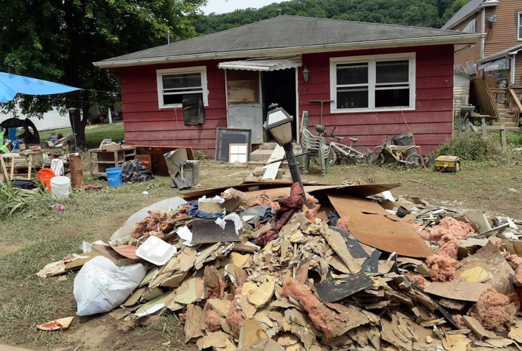


West Virginia’s flood damages in the past two decades have been devastating.
The state suffered over 2,100 flood and flash flood events that resulted in 39 deaths and over $464.1 million in property damage from 2004 through March 2023, according to National Oceanic and Atmospheric Administration data.
Floods are longer-term events that may last days or weeks, while flash floods are caused by heavy rainfall in a short period of time, usually under six hours.
The state developed its flood protection plan in 2004, but officials have ignored most of it.
Just 14% of the plan’s approximately 140 components were addressed or completed, according to a synthesis of feedback compiled by Pew Charitable Trusts from flood preparedness and response experts in academia, nongovernmental groups and state and local government.
The nongovernmental public policy group gathered that feedback at a flood symposium it cohosted with the State Resiliency Office and SBP, a national disaster recovery firm, in Charleston last year.
Participants at the symposium, where attendee discussions were closed to media, cited lack of coordination and clearly identified leadership on flood preparedness issues as a barrier to progress across 2004 plan goals, according to the synthesis.
State officials and stakeholders stressed unclear roles and responsibilities were a significant barrier to stormwater and flood management. But potential solutions emerged during and after the symposium that point the way toward greater protection in West Virginia as the flood-prone state contends with aging flood maps, disproportionately low flood insurance uptake and an unforgiving topography.
Now it’s up to the state to fund them.
“And if it is not funded, then it’s meaningless,” West Virginia University assistant professor of forest hydrology Nicolas Zegre said.
Infrastructural solutions
Pew Charitable Trusts said participants identified a need for the state to invest in local floodplain management capacity and provide for enhanced training for local floodplain managers. Floodplain managers typically rely on zoning or building requirements and floodplain ordinances to guard against flood damage.
Participants said training should include offerings through not only an Association of State Floodplain Managers program but West Virginia-specific floodplain management training reflecting the state’s mountainous terrain and waterway network.
They reported undersized culverts and insufficient mechanisms accounting for stormwater runoff, according to Pew’s report. The report also noted calls on the state and localities to invest in maintenance to prevent clogs that can cause flooding.
Steve Neddo, Kanawha County’s planning director, said flooding often is caused by man-made issues like improperly placed or undersized culverts and bridges.
“Culverts are a big problem,” Kanawha County Floodplain Manager Bruce White agreed, sitting next to Neddo in a downtown Charleston county office room.
“[It’s] simple things like people not cleaning out their culverts and letting sediment just slowly build up,” Neddo said, noting that mud and sediment can reduce a 15-inch culvert to essentially half its size, stripping it of water retention capacity.
Recommendations resulting from the symposium included culvert and stormwater sizing, establishing a master list of infrastructure projects prioritized by county and addressing aging storm drains with grate designs. The latter should aim to prevent debris buildup and to protect humans from potentially being pinned to the grate in a flash flood.
Participants also called for the state to advocate for nature-based flood solutions, which include restoring watersheds and wetlands, reforestation, roadside plants and other practices that limit runoff.
Zegre suggested watershed restoration as a tool to limit erosion in a phone interview. He also recommended restoring forested areas of land next to rivers and streams as a path to slowing down water velocity.
Symposium participants cited stream restoration as a chance to limit flood risk. They prioritized streams in flood-prone areas for regular monitoring and sharing monitoring data across agencies to use to inform permitting decisions.
Zegre touted leaky dams, a natural flood management approach in which trees or logs in a water channel slow down water flow.
Artificial dams, of which there are hundreds in West Virginia, are another means of flood control.
But nearly half of West Virginia dams have been identified as having high hazard downstream potential, according to a proposed update to the state’s Hazard Mitigation Plan that emergency officials plan to use to identify and implement risk reduction projects.
FEMA categorizes downstream hazard potential into three categories: low, significant and high.
Of West Virginia’s 632 dams, 296 are in the latter category, according to the proposed plan update published by the state Emergency Management Division.
The state Department of Environmental Protection evaluates dams based on hazard potential related to potential for downstream flooding rather than the structural integrity of the dam, the proposed update noted.
The Emergency Management Division listed 26 dam failure events in West Virginia since 1890 and none since 2009. The agency noted that many older dams aren’t designed to modern standards and may not withstand extreme weather events — and that flooding and precipitation events are projected to increase.
“This increased dam failure risk from projected flooding and precipitation events can lead to loss of life and property; impacts to the economy, infrastructure, and community; loss of water resources; and loss of flood protection,” the proposed plan update noted. “With these projections, more intense events, combined with the aging dam infrastructure, could result in more dam failure incidents.”
The plan update reported West Virginia’s total replacement cost value for state facilities within dam failure inundation areas is roughly $983 million.
The state plans to seek FEMA grant funding to address five high-hazard dams, officials noted during a listening session on the plan update proposal Friday.
Flood map age and accuracy under scrutiny
Zegre noted that water restoration efforts can only go so far given that many West Virginians live along roads next to rivers.
“So if we were to restore the river or restore the floodplain, we would have to remove the road, and then we would remove the … infrastructure and people’s homes and businesses along that road,” Zegre said. “And so that’s not a meaningful solution. If we remove people from the flood zone, then it’s really not a flood problem.”
As a result, Zegre is thinking more about how to adapt to extreme rainfall and flooding rather than flood mitigation.
“[I]f we’re going to save lives and we’re going to enhance livelihoods, we need to figure out how to respond but also adapt to these types of floods,” Zegre said.
That’s where flood maps come in.
Less than a fifth of West Virginia’s 278 community flood maps have been updated in the past 10 years, according to FEMA data.
New maps for Kanawha County, the city of Charleston and the town of Clendenin take effect Aug. 1, per FEMA data.
Neddo said updated mapping along the Elk River was enhanced by local water elevation studies immediately following the June 2016 flood.
“These are maps with better information, more accurate information,” Neddo said. “Before, the information was kind of guessed at using topography to determine where the water goes. But with the information from 2016 that we were able to gather, we know exactly where the water was.”
A FEMA spokesperson said flood maps are dynamic and need to be updated but added that the age of a map doesn’t necessarily reflect its accuracy. FEMA reassesses studies behind each map every five years to see if engineering data and hydraulic and hydrologic models used to create it still meet current engineering standards, according to the spokesperson.
Areas that need to be updated are identified in a process coordinated at the regional level with state and local partners, the spokesperson said. FEMA said communities can request changes to flood maps at any time, and that the agency receives 1,500 map revision requests each year.
FEMA Region 3, which includes West Virginia, is finishing flood studies for some Southern West Virginia watersheds, the spokesperson said. Region 3 is also planning to fund flood studies throughout Northern and Central West Virginia.
On its maps, FEMA outlines Special Flood Hazard Areas, zones with special flood and flood-related erosion hazards where flood insurance is required.
There’s concern that flood data FEMA produces aren’t sufficient.
Stories you might like
- South Charleston toxic landfill in early stages of Superfund probe; cleanup future unclear
- Appalachian Power seeks renewable energy proposals
- Jury awards $15M to family after death caused by Kanawha County chemical explosion
- Wyoming County mine operator had long safety violation history before fatal injury
Flood symposium participants said West Virginia can’t depend solely on FEMA flood maps because they use historic data and fail to account for risk of flash floods, which are especially common in the Mountain State.
FEMA flood maps historically have focused on riverine and coastal flooding hazards rather than pluvial floods, in which rain falls faster than soil or drainage systems can absorb it.
Zegre noted that pluvial floods can happen anywhere and arguably are West Virginia’s greatest hazard given its steep topography, shallow soils and increasingly intense rain due to a warming atmosphere.
The First Street Foundation, a Brooklyn, New York-based firm that quantifies climate risks, released a study last month finding that just over half the U.S. population lives in areas twice as likely to experience a severe “1-in-100-year flood” event as expected from the federal standard for precipitation projections.
The foundation found that of 17.7 million properties nationwide at significant flood risk, 12.6 million aren’t included in FEMA Special Flood Hazard Areas.
“The magnitude of the changes in expected rainfall intensity are startling for many areas in the United States, and it is important that Americans are fully aware of this consequence of climate change that can impact their lives and homes,” Jungho Kim, First Street’s senior hydrologist and lead author of the peer-reviewed study, said in the group’s announcement of the findings.
The FEMA spokesperson said the flood data the agency produces and First Street’s risk assessment tool use different data and analysis. The agency’s data “requires a level of precision that is sufficient” for local decision-making, setting insurance premiums and grant evaluations, the spokesperson said.
“We’re encouraged to see private sector and non-profit entities building on federal agency datasets and the information included in our flood maps to bring together new data and technology in order to visualize flood hazard information in a different and useful way,” the spokesperson added.
FEMA is moving away from a binary depiction of risk that rests on being inside or outside a Special Flood Hazard Area, but isn’t planning to phase those areas out.
High costs, low uptake
Uptake of insurance through the National Flood Insurance Program, the FEMA-managed program that provides flood insurance to property owners, renters and businesses, is particularly low in West Virginia.
Homeowners insurance typically doesn’t cover flood damage. In Special Flood Hazard Areas, buying flood insurance is mandatory. A FEMA spokesperson encouraged anyone living in or near a Special Flood Hazard Area to buy insurance but said it’s only required by lenders when a property has a federally backed mortgage.
In West Virginia, just 12% of residential properties in Special Flood Hazard Areas have flood insurance through the National Flood Insurance Program, according to FEMA — well below the national clip of 40%.
There are 10,292 National Flood Insurance Program policies in force totaling approximately $1.82 billion in coverage, the state reported in its Hazard Mitigation Plan update.
The number of policies fell 37% from the state’s last plan update in 2018.
West Virginia’s poverty level — fifth-highest nationally from 2019 to 2021 — and high concentration of flood-prone areas make flood insurance hard to afford but risky to live without for many in the state.
The average yearly current cost of National Flood Insurance Program insurance for state residents as of September 2022 was $1,133, eighth-highest in the country.
But West Virginia’s average risk-based cost of insurance of $3,074 was the nation’s highest.
Risk-based cost of insurance is what policyholders would pay if they were paying their full actuarial rate as evaluated under the rates implemented per a new FEMA insurance pricing methodology, Risk Rating 2.0. The new methodology was implemented in 2021.
When a policyholder’s current premium is below their risk-based premium, their premium will rise toward the full rate, meaning West Virginia’s federal flood insurance premiums are poised to keep escalating.
Rates can’t increase by more than 18% per year for most policyholders by law.
The increase in policy premiums in high-risk regions has resulted in calls for a means-tested assistance program that gives flood insurance discounts to eligible policyholders.
Symposium participants suggested promoting flood insurance beyond Special Flood Hazard Areas by educating people outside those areas they’re also at risk of flooding. They also suggested pooling funding to help homeowners afford flood insurance and to buy out properties when insurance is too expensive.
“We know West Virginia has a very low rate of flood insurance, so people who lose their homes during a flood may never get it back,” Zegre said.
‘It needs to get funded’
Zegre has high hopes for a law passed by the Legislature in March aimed at addressing the state’s high flood vulnerability.
Senate Bill 677 created a new trust fund to prioritize nature-based flood protection and prevention solutions for low-income areas with a potential allocation of $40 million.
Under SB 677, the State Resiliency Office will administer the already existing Disaster Recovery Trust Fund, removed from the jurisdiction of state homeland security and emergency management officials. The fund could be granted an initial one-time $10 million allocation, with the State Resiliency Office Board able to seek $10 million replenishment annually.
But the bill, which Pew Charitable Trusts worked on with state lawmakers, doesn’t allocate any funding.
Mathew Sanders, a senior manager with Pew Charitable Trusts focusing on community flood preparation, recalled some lawmaker “reticence” to structure the fund so that it would be a long-term part of the budget.
The Legislature’s choice not to fund the Flood Resiliency Trust Fund comes amid a state budget surplus touted by Gov. Jim Justice, who announced June 30 that $454 million would be left unappropriated after appropriating $1.16 billion of the fiscal year 2023 surplus.
A spokesperson for the State Resiliency Office, West Virginia’s disaster strategy unit, didn’t respond to requests for comment.
Neddo said SB 677 could provide funding that enhances local disaster response.
“The locals show up and, basically, we get things started, but we’re waiting for FEMA to show up with the actual funding, whether it be cash in hand or whether it be SBA [U.S. Small Business Administration] loans or whatever,” Neddo said.
Zegre called SB 677 “one of the most forward-thinking flood bills out there” due to its embrace of nature-based solutions and recognition of a connection between flooding and social vulnerability.
At least half of all funds spent through the Flood Resiliency Trust Fund and the Disaster Recovery Trust Fund after a disaster would have to benefit low-income areas or households.
“[B]ut of course, it needs to get funded,” Zegre said.
State Resiliency Officer Bob Martin made a connection between flood resiliency and economic health before a panel of state lawmakers during an April legislative meeting.
“This is the world according to Bob: I think flood resiliency and flood mitigation in the state of West Virginia is probably the baseline of economic development for the state,” Martin told lawmakers. “I think that’s what will create the most prosperity for the state. If we can control the water and utilize the water to our good, bend it to our will, we’ll get there.”
But there’s a limit to what the state can do about rising floodwaters without greater investment.
“As far as Senate Bill 677, we’ll really be looking for the Legislature to put together an idea of funding for it, and then the guidance that would come with that,” Martin told lawmakers.
Zegre wants residents across the state to have their say on flood planning.
“There needs to be a commitment to coproducing knowledge with those community members by being present, by offering public meetings,” Zegre said.
In the meantime, White knows something flood experts say all West Virginians should know.
“It will flood,” White said. “If [you’re] in a flood-prone area, it will flood.”
This story was supported by the Massachusetts Institute of Technology Environmental Solutions Initiative. The program supports journalists developing a news project that connects local perspectives and priorities with climate change science and solutions.
CLICK HERE to follow the Charleston Gazette-Mail and receive

